#Speculative Design
#Sound Narrative Design
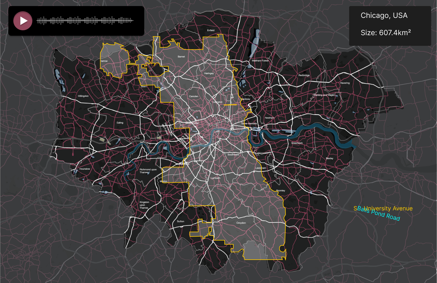
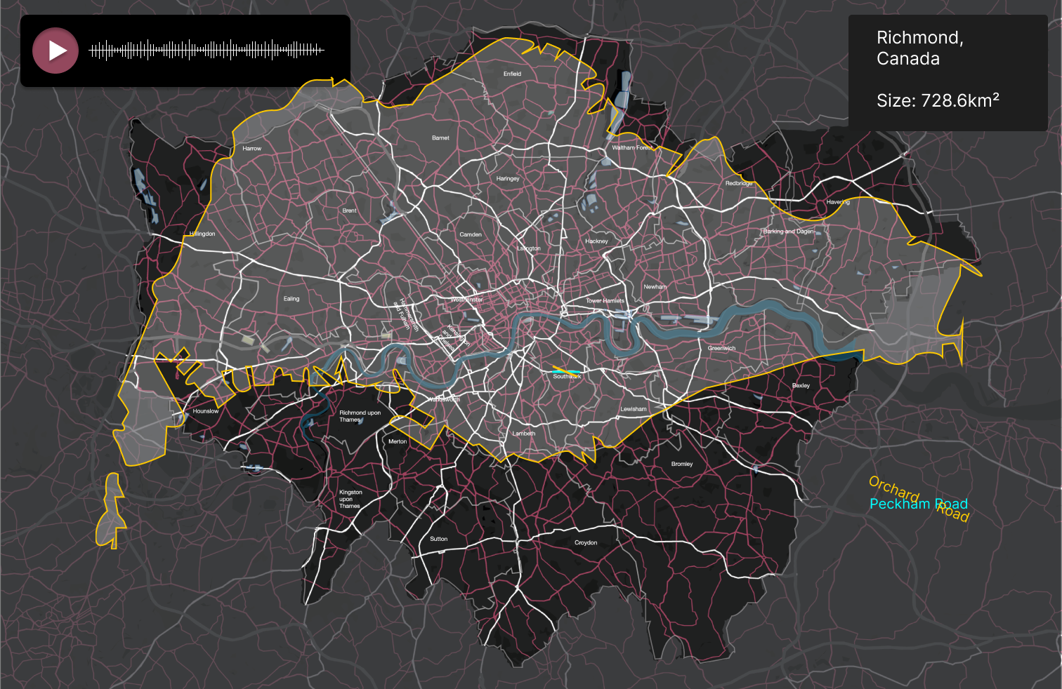
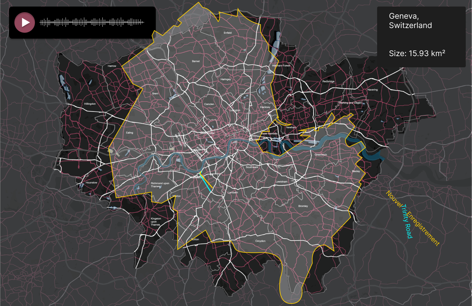
Maps are one of the most essential tools for navigation. But what happens if we use the wrong map? For instance, what if I used a map of Chicago to navigate London? This project explores the tension between subjective perception and spatial cognition by merging maps with sensory experiences.
地图是最重要的导航工具之一。但是如果我们用错了地图会怎么样呢?例如,如果我用芝加哥的地图来导航伦敦会怎么样?该项目通过将地图与感官体验相结合,探索主观感知与空间认知之间的张力。
I began by conducting a survey, gathering over 600 responses from people around the world about their impressions of their local environments, including the sounds and smells that define them.
通过公共征集,我收集到了来自世界各地的600多名受访者对当地环境的印象,包括定义当地环境的声音和气味。
Next, I invited a dozen participants to choose a street in their neighborhood and record the sounds of walking along it. These recordings were then linked to their respective cities' maps. By overlaying these maps onto London’s map—my home city—I marked the corresponding streets in London. Finally, I visited these streets in London, documenting what I saw while playing the recorded sounds from the other cities.
接下来,我邀请了十几个参与者在他们附近选择一条街道,并记录行走的声音。然后将这些录音与他们各自城市的地图联系起来。通过将这些地图叠加到伦敦的地图上——我的家乡城市——我在伦敦相应的街道上做了标记。最后,我参观了伦敦的这些街道,记录了我在播放其他城市录制的声音时所看到的。
This experimental dialogue probes several questions: What cognitive dissonance or new associations emerge when sensory memories (like sounds or smells) from elsewhere redefine familiar spaces? How do people in different parts of the world use sensory experiences to construct unique impressions of their cities? In an increasingly globalized world, how can individual urban experiences be mapped onto someone else’s local context?
这个实验性对话探讨了几个问题:当来自其他地方的感官记忆(如声音或气味)重新定义熟悉的空间时,会出现什么样的认知失调或新的联想?世界不同地区的人们如何利用感官体验来构建他们对城市的独特印象?在一个日益全球化的世界中,如何将个人的城市经历映射到其他人的当地背景中?
By challenging the traditional function of maps as purely navigational tools, this project reimagines maps as sensory media—capable of connecting diverse experiences and reinterpreting the spaces we inhabit.
通过挑战地图作为纯粹导航工具的传统功能,该项目将地图重新想象为能够连接各种体验并重新解释我们居住的空间的感官媒体。
Click here to watch the video